

After riding along the concrete barrier across the Destin Bridge in 123 mph wind gusts, the WBWX team stood on the beaches east of Destin where we felt Hurricane Isaias expel warm air on our faces. That blast of warm air was the storms warm core coming onshore, and it was certainly a unique feature to feel in person.
This is a recap of how our team went from a low-confidence model signal to the center of Major Hurricane Isaias in under a week.
We will discuss the drive to the coast, the decision on where to ride the storm out, the eyewall and eye itself, the meteorology we still do not understand, and what we found when the sun rose the day after the Florida panhandle was devastated.
The Setup
We started watching the Gulf on October 3rd,2026. At this point, there was nothing noted or established by the NHC (tropical storm/depression, or invest name).
However, we noticed models were signaling something intriguing.
On October 4th, the 06z run of the Google DeepMind ensemble bit the bait.
Out of 1,000 ensemble members, 55% developed a tropical cyclone, 24% reached hurricane strength, and 8% reached major hurricane strength.
That same day, the National Hurricane Center introduced a 40% chance of formation over the next 7 days.
I also noticed the calendar; landfall timing lined up with fall break for my master’s program at Mississippi State.
That afternoon, I sent the DeepMind run to Mark Sudduth from HurricaneTrack and told him the timing was perfect: “If we get a named storm this weekend, I’ll be there, let me know how I can help, and I’ll bring more hands.”
The storm continued to come together day by day, and was given the name ‘Isaias’ on October 7th, 2026.
It became the first hurricane of the 2026 Atlantic season on October 8th: the latest first hurricane of a season since we invented satellites.
Once model guidance suggested landfall within a 4 to 6 hour drive of Starkville, MS, I decided we were going to intercept.
The plan: help Mark deploy his camera network ahead of landfall and collect data that the National Hurricane Center could use in its review of the storm, plus aiding in the documentation of the storm.
The Drive
The drive from Starkville, MS to Destin, FL took about 6 hours.
Sam Hurd, another master’s student at Miss. State, rode shotgun and ran navigation, current weather observation analysis, and socials.
Cole Sand, another master’s student at Miss. State, handled logistics: the hotel and keeping us fed on schedule.
Mikey Plemmons and Tim Kern, WBWX storm chasers, met us on the coast to film and chase.
The ride down was pure excitement. As we were about an hour into our drive, we could see the leading edge of Hurricane Isaias’s upper-level cirrus clouds spreading across the sky from our car.
That was the moment the storm stopped being a model run and became real.
When we rolled into Destin on the 8th, we were surprised by how many people were still in the city.
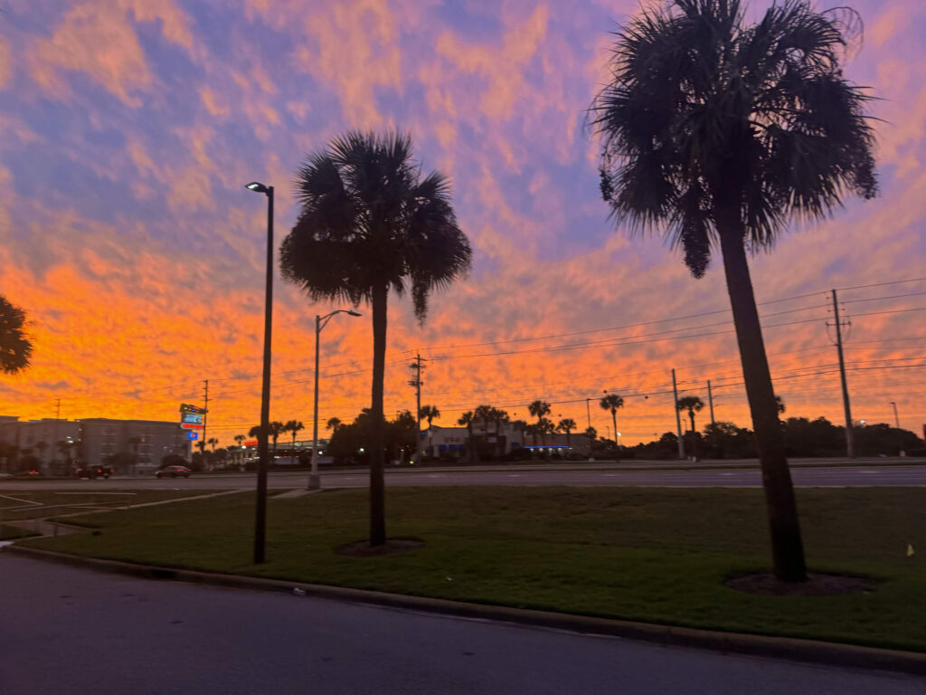
But, by the afternoon of landfall day (October 9th), most of the city folk had cleared out or hunkered down.
The eeriest part had come that night before: we didn’t see a single bird. Every living thing except us and a handful of locals had already took shelter.
The Target
The target city bounced around all week.
About 48 hours before landfall, we agreed on Destin, Florida.
A big reason we trusted that call was because of the Google DeepMind guidance.
It had been verifying well since before there was an “Invest”, and we felt it handled the wind shear and the upcoming trough interaction that steered the storm better than anything else we were looking at.
For the eyewall itself, we set up on Okaloosa Island, the thin strip of barrier island between Destin and Fort Walton Beach, along the Miracle Strip Parkway.
This spot was Mark’s call, and it came straight from his experience.
When you’re chasing with the man who has been in more United States hurricanes than anyone else in history (as far as we know), you just have to trust him.
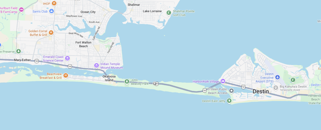
Okaloosa Island was under a mandatory evacuation’ and on a map, it looks like the last place you would want to be during a hurricane.
But Mark knew the wind on the west side of the storm would blow mostly offshore, so storm surge wouldn’t be an issue for our location. The tall sand dunes on the south side of the island also gave us an extra layer of protection.
This setup worked well even though Isaias was not a textbook storm.
Typically, the strongest winds sit in the northeast quadrant of a hurricane.
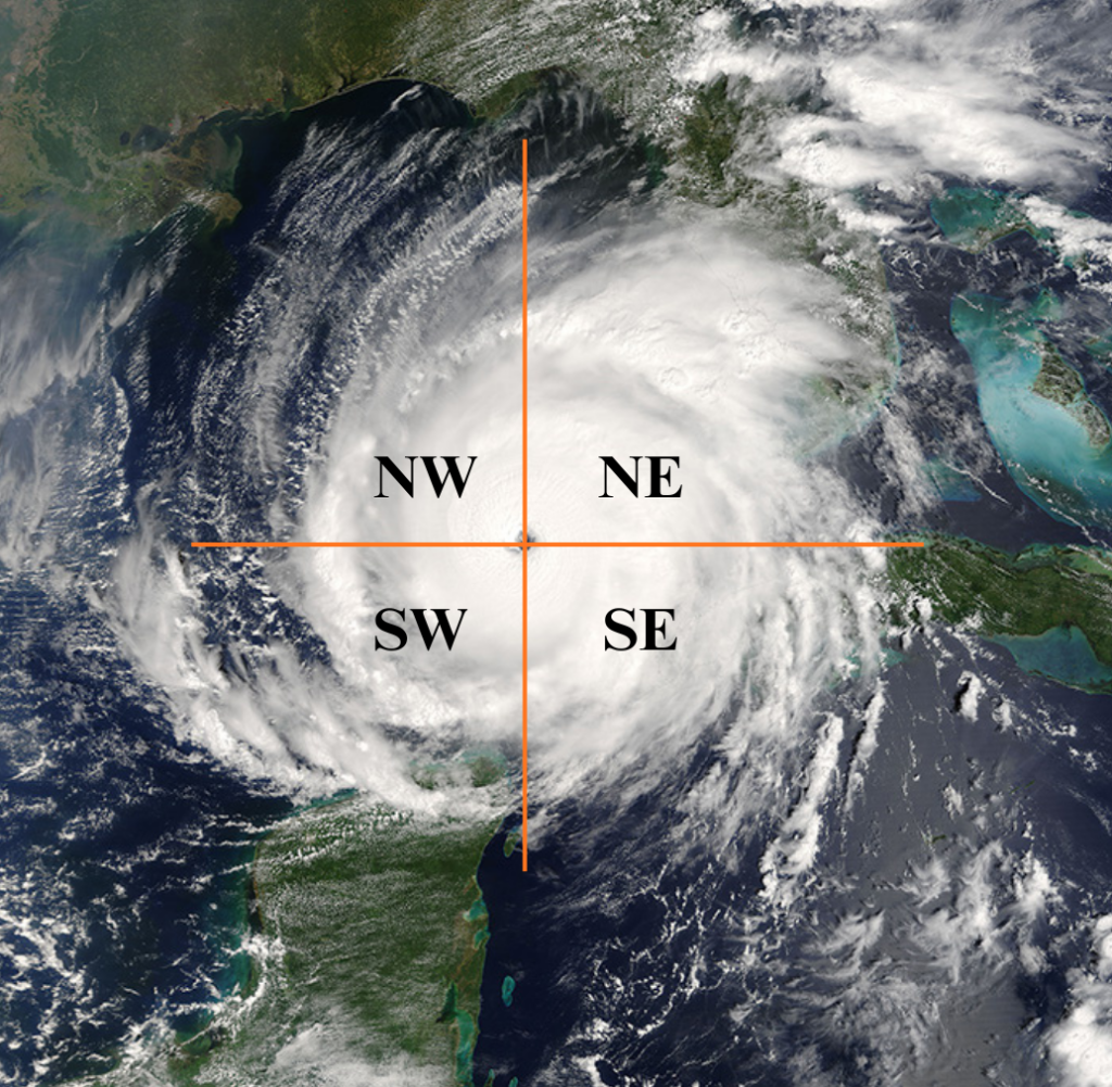
In Isaias, the strongest winds were in the northwest and southwest quadrants.
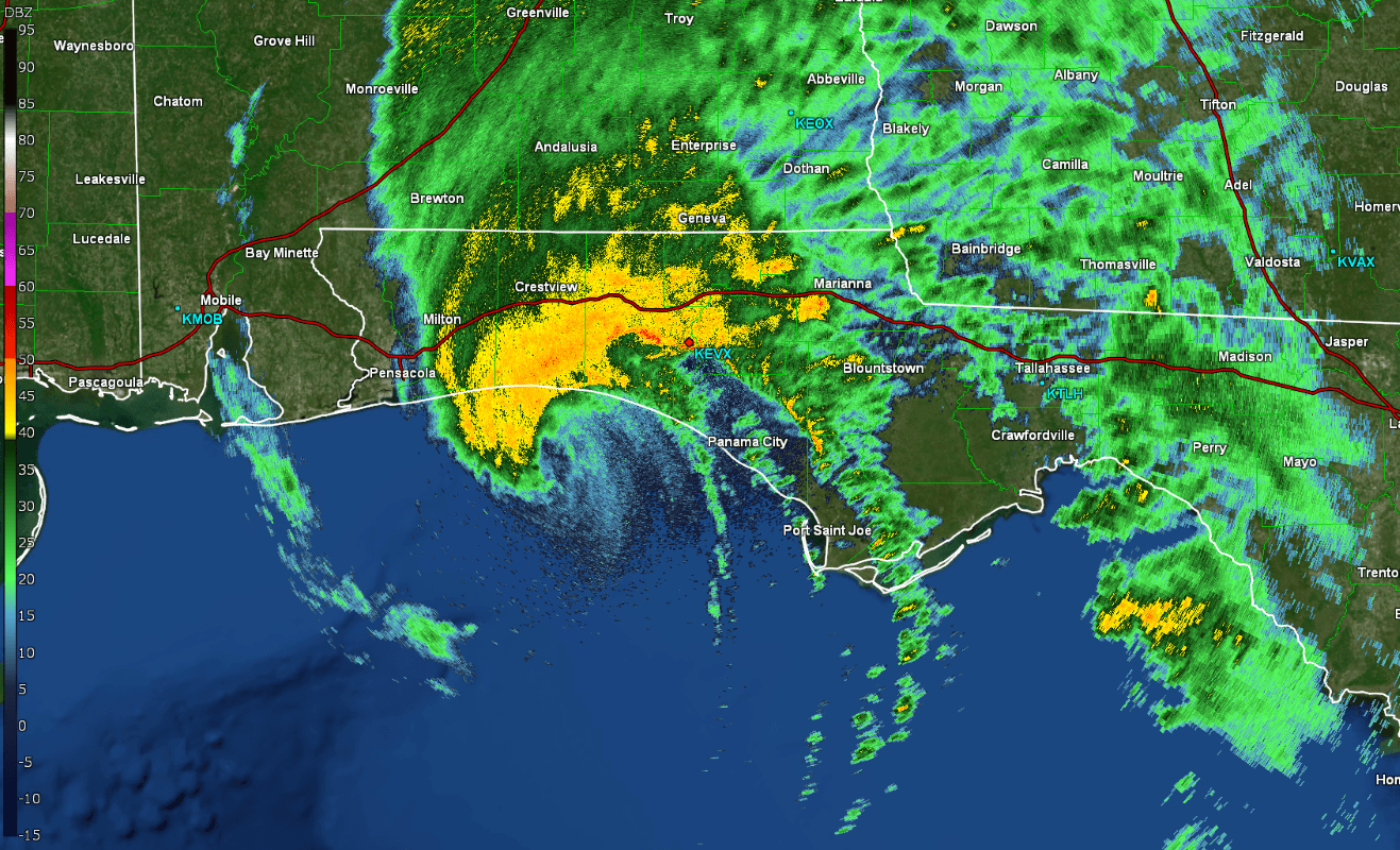
The southeastern part of the eyewall dried out and collapsed close to landfall while the eye expanded, and a sting-jet-like feature developed on the west side. More on that below:
The Eyewall and Sting-Jet:
The outer eyewall arrived just before sunset, and we were not alone on Okaloosa Island.
We ran into a bunch of other chasers, including Reed Timmer, and hung out with his crew for a while before things got serious.
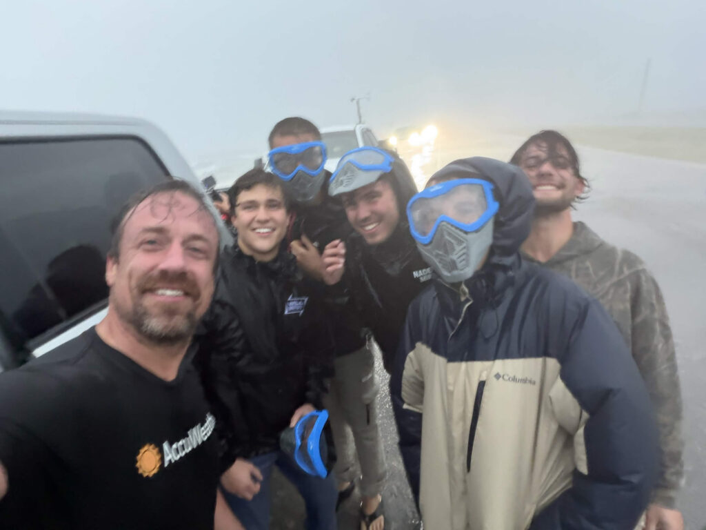
The inner eyewall followed around 7:45 p.m., and with it came the sting-jet-like feature on the west side of the storm.
The howl from the winds sounded like something out of a movie on another planet. At times, all you could see was white, with visibility below ten feet.
The scariest moment of the chase came when we left Okaloosa Island and crossed the Destin Bridge around 8:30p.m. Around then, a 123mph wind gust was measured in our area, which was strong enough to begin lifting Mark’s truck.
We rode the left-hand concrete barrier the entire way down the bridge so we could try our best to keep the vehicles flat.
Because the eyewall was passing over us at the exact moment we were crossing the bridge, the wind began changing directions.
One detail that still fascinates me, is that on the south side of the bridge, Mark’s weather station only recorded wind gusts in the upper 80s. As the wind hit the bridge, friction began slowing those winds to well below what we were actually feeling as we drove across the bridge.
Inside the Eye
The timing of that bridge crossing turned out to be perfect.
The National Hurricane Center put landfall near Destin at about 8:30 p.m. CDT, which means we were crossing into Destin as the eye was coming ashore.
Once in Destin, the dry, collapsing part of the eye began to come ashore, which changed the character of the storm completely.
We no longer had the roaring of the wind in our ears or have such low visibility as before.
We then felt a very uncharacteristically warm swath of air as the warm core made landfall. The jump in temperature was impossible to miss as most of the night the rain and wind were cooler.
The Meteorology
Isaias went from a tropical depression to a major hurricane in about two and a half days, then fell apart under wind shear in its final hours over water. ‘
That race between intensification and shear decided what the coast actually felt:
| Milestone | Time | Winds | Pressure |
|---|---|---|---|
| Tropical Depression Nine forms, southwest Gulf | Oct 6, 21:00 UTC | — | — |
| Named Tropical Storm Isaias | Oct 7, 09:00 UTC | — | — |
| First Atlantic hurricane of the 2026 season | Oct 8, 03:30 UTC | 75 mph | 981 mb |
| Peak intensity, Category 3 | Oct 9, morning | 120 mph | 958 mb |
| Landfall near Destin, Category 2 | Oct 9, 8:30 p.m. CDT | 105 mph | 971 mb |
| Post-tropical over Alabama | Oct 10, 06:00 UTC | — | — |
The intensification was fueled by high ocean heat content, a moist mid-level environment, and weaker-than-usual Gulf shear for a tropical season dominated by El Niño.
On the afternoon of landfall, deep-layer southwesterly shear jumped from 30 to 40 knots.
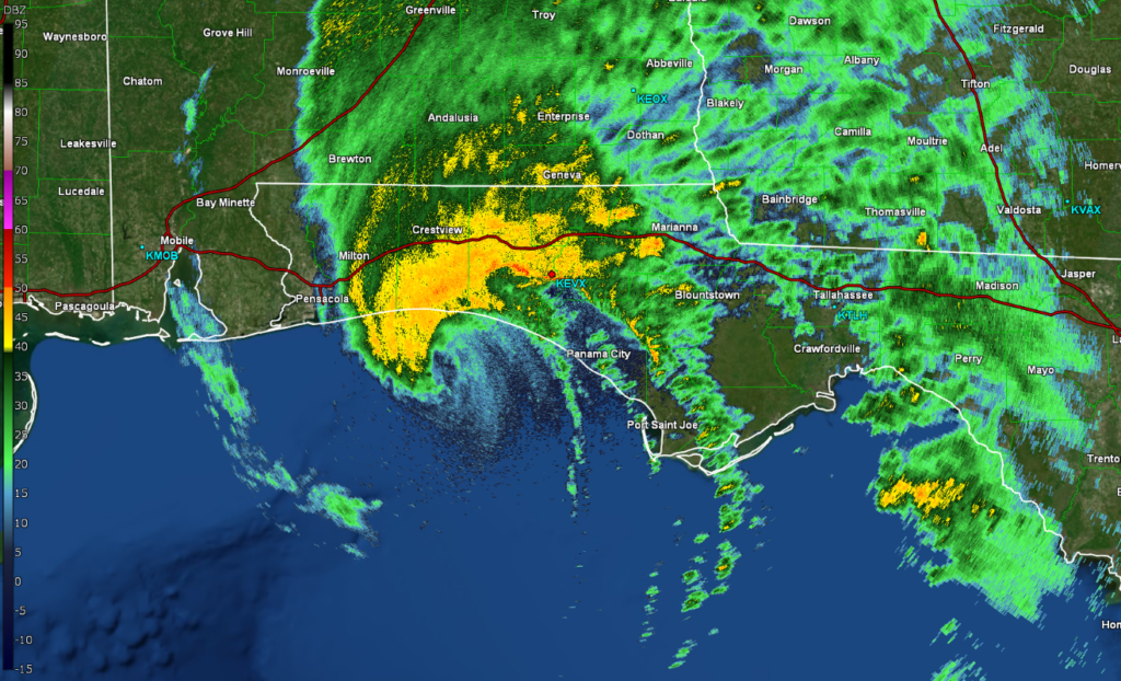
The NHC described the storm as becoming increasingly lopsided, with the most intense convection confined to the northern eyewall and a slight tilt on the vertical profile of its core.
This matches what we watched on radar: shear began tearing up the west side of the outer eyewall as Isaias pushed north.
Author’s Notes
You may have seen on social media that Hurricane Isaias reached a category 4, but this is false.
Hurricane Hunters did in fact measure a 136 knot wind (157mph), but that specific measurement was taken at 10,000 feet. These are flight level winds, not surface level, which do not qualify to categorize a storm.
Dropsondes in the eyewall showed winds slowing down significantly the closer they got to the surface. This is why the NHC confirmed the landfall wind estimate as 105 mph (category 2).
The NHC’s 4 p.m. discussion also flagged that Isaias would likely be a gustier-than-normal hurricane, and the observations back that up.
A WeatherFlow station near Santa Rosa Sound measured one gust up to 116 mph, a station near Pensacola measured 100 mph, Pensacola City Hall reported 102 mph, and Jay, Florida, well inland, measured 118 mph.
Whether any of this changes the official landfall intensity will be settled in the NHC’s post-storm Tropical Cyclone Report that will be published in the coming months.
On the forecasting side, the Google DeepMind ensemble deserves immense credit, and we were able to analyze it thanks to incredible visuals from James Pettus’ PettusPlots.
It signaled development before the NHC had an invest, and it effectively handled the shear and the upper level trough interaction that steered Isaias north into Destin.
The ensemble nailed so many key components with incredible lead time, including the track, peak intensity, timing, and the even the collapse close to the coast associated with the shear in the northern Gulf.
The Questions
The biggest open question from Isaias is what caused the wind damage around Pensacola, west of the landfall point.
It has been widely debated online, and I keep going back and forth on it myself.
I have tossed and turned between two main schools of thought:
- A microburst-like downdraft: evaporative cooling in the rain could have driven strong downbursts to the surface. I am skeptical of this because the rain felt surprisingly cool for a tropical system. With a cool rain, the temperature contrast needed to power a downdraft that strong should not have been large enough to do what we saw in Pensacola.
- A displaced sting jet. This is the idea I lean toward right now. As the southeast side of the eyewall dried out and the eye expanded, the strongest descending flow may have shifted west of where you would normally expect it, bringing a sting-jet-like core of wind down toward Pensacola.
Two observations keep pulling me toward the sting jet idea.
First, when we intercepted the dry part of the eyewall east of Destin, temperatures warmed drastically across a broad swath as the warm core hit us.
Second, temperatures elsewhere around the storm were much cooler than I expected (and cooler than normal according to Mark and CJ, who have far more tropical intercept experience than I do).
That contrast between a warm core and an unusually cool environment seems like an important clue.
It has been racking my brain since Saturday, and I am glad I am not the only one. Here is what I think the team should study up on:
- Sting jets and how they apply to tropical cyclones. The concept comes from mid-latitude cyclones, so how well does it translate to a sheared, decaying hurricane?
- Asymmetric eyewall collapse under strong shear. Why did the southeast eyewall dry out first, and how did that shift the strongest winds to the west side?
- Gust factors in sheared, fast-moving landfalls. Why the gusts at Santa Rosa Sound and inland in Jay ran so high relative to the sustained winds.
- Surface roughness and measurement siting. Mark’s station on the bridge read upper-80s gusts while we felt far more on the span. How much do siting and friction shape the official wind record?
- The NHC’s final Tropical Cyclone Report. When it comes out, it will show whether the data we helped collect changes the story.
The Aftermath
That night, we went back to the same hotel we had stayed in before the storm. It had no power, and none of us cared.
In the morning, Destin looked better than we expected.
Governor DeSantis said Okaloosa County’s structures handled the storm very well, and that matched what we saw.
As we drove west, the damage became more widespread: roof damage, downed trees, and a mish-mosh of debris, seaweed, sand, and surge sludge.
It took almost three hours of driving before we reached areas with consistent power.
Across the southeast, nearly 700,000 customers were still without power the morning after landfall, including more than 300,000 in Alabama.
Isaias was not harmless. At least four people died, including a woman in Escambia County, FL killed when a tree fell on her home, and a man who died from running a generator inside his home.
Niceville picked up just over 8 inches of rain, and a water level gauge in Panama City Beach recorded 5.6 feet above mean water level.
In summary, I would not change a thing about this chase.
The forecast, the target, the timing, the safety call on Okaloosa Island, and the team all came together perfectly.
It was about as close to a flawless intercept that I could ask for, and I came home with more questions than I left with (which is exactly how it should be).
As meteorologists, we must never be satisfied with our knowledge. Curiosity is the key that unlocks the future of the science.
Comments
Join the Conversation