

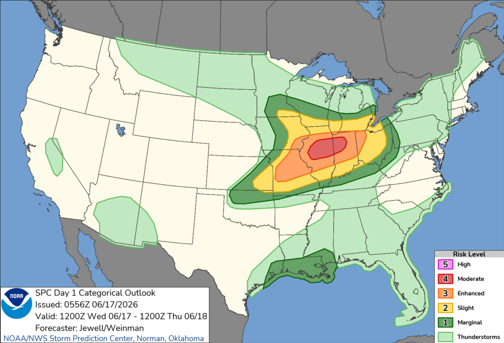
On the morning of June 17th, 2026, the Storm Prediction Center issued a Moderate Risk for severe storms across portions of Illinois and Indiana. Their outlook contained concerning wording that caught my eye:
Day 1 Convective Outlook
NWS Storm Prediction Center Norman OK
1256 AM CDT Wed Jun 17 2026
Valid 171200Z – 181200Z
…THERE IS A MODERATE RISK OF SEVERE THUNDERSTORMS OVER ILLINOIS AND INDIANA …
…SUMMARY…
An outbreak of severe thunderstorms is expected today, with primary threat centered over Illinois and Indiana. Several intense tornadoes, swaths of damaging gusts over 75 mph and damaging wind-driven hail will all be possible.
On a whim, I decided to drive out to Illinois from Colorado, overnighting with family in Kansas City the night before. It was an exhausting grind to make it out, and I knew my timing was risky; I was cutting it close to storm initiation in my target city Springfield, IL.
When chasing, I strongly prefer to arrive in my target area in the morning (if not the night before) just in case storms develop earlier in the day than anticipated, but I just had to try my luck and hope that I could make it in time.
I battled seemingly constant road construction throughout portions of Missouri and truly wondered if I would be too late to the show. However, I kept pushing onward, hoping for the best.
The main concern with the chase setup on June 17th was storm motion, or the direction in which storms move. Numerical model data and forecasts from the SPC indicated storm motions of 60 mph or more, which is extremely fast and makes the storms hard to keep up with. When chasing such fast-moving storms, the margin for error is extremely slim. The pressure to pick the right storms at the right time is extremely high.
A typical approach with these setups is to position myself ahead of the storms as best I can, and wait for them to come to me. Then, I might have a brief opportunity to view a tornado before it races away, and my chase is done.
By 2:45pm, I met up with some chaser friends in Springfield as storms began firing off to the west and northwest. After we hopped in the car, we moved east of the Springfield metro into a better position for the first round of storms.
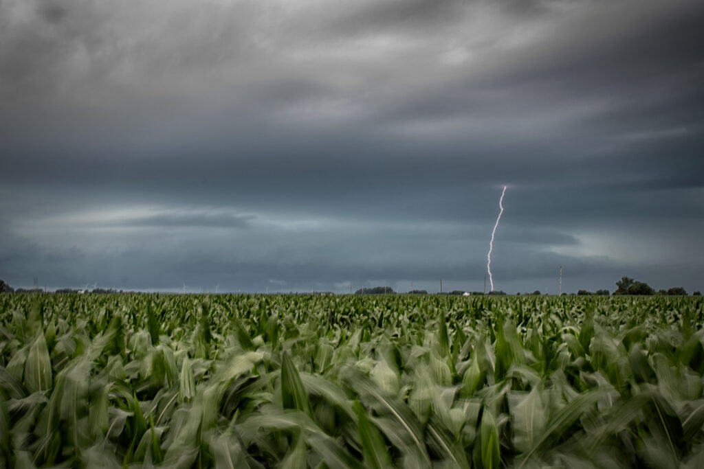
This tornado-warned supercell crossed out path to the north around 4:30pm CDT. It was producing consistent CGs (cloud-to-ground lightning bolts), so we set up our cameras and tripods to catch a few of these bolts.
We let the storm move off to the east as we awaited stronger storms to our west meet us. These storms were moving quickly, but patience is a virtue in the chasing community, and we didn’t want to hop on the first storm we saw.
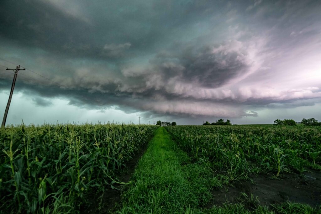
We tracked a handful of storms, including this impressively-structured storm that moved through the town of Bethany, dropping baseball-sized hail as it did so, and driving visibility to near zero. We knew we would not be able to outrun the storm to stay ahead of it due to its rapid forward speed, so we let it pass over us in town.
Mere moments after the storm passed over us, a tornado was reported just southwest of town, which was rated an EF-1 with maximum wind speeds of 100 mph. We were fortunate to have a near-miss, as it was a pretty dicey move to let the velocity couplet pass so close to us while having such limited visibility.
We then noticed an intensifying tornado-warned storm to our southwest, so we hurriedly dropped south, hoping we could position ourselves ahead of it in time.
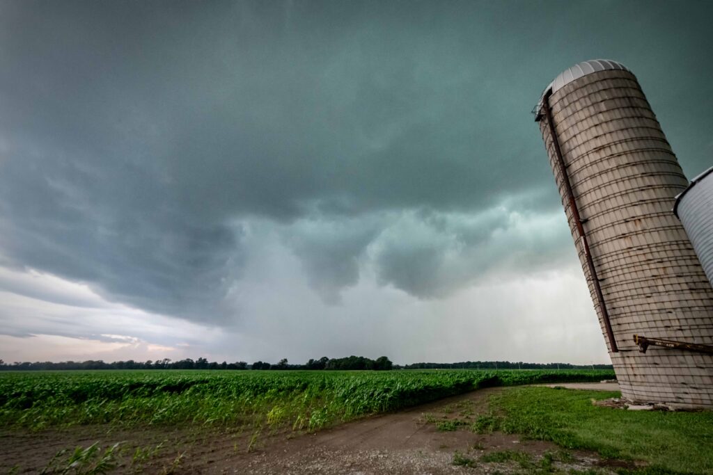
We made it just in time to set up next to a grain silo just south of Beecher City and watch this funnel cloud moving hastily toward us.
We all got out of the vehicle to get a better visual, and as I began filming the storm, I noticed rapidly wrapping rain bands in the field in front of us. I realized we needed to move, and fast, because while this developing tornado was not fully condensed, it was likely going to be soon, and we were directly in its path.
It was at that moment that I realized one of the people in our group was missing. As I waited anxiously for him to get back to the car, I kept filming, watching the rain bands moving closer and closer with some truly violent motion. My heart began to race – we had mere seconds to get out of the way now.
Thankfully, at the last possible second, our other party member got back into the car. By that point, our only choice was to shelter behind the grain silo next to us and hope it would protect us from the strong winds.
The car began rocking, and the next thing we knew, the lid of the grain silo was being lifted over our car and tossed into the field to our right, merely a few tens of yards away. Tree debris began raining down all around us, the wind howled, and I really worried the car might be tossed at any moment.
Finally, the wind began to die down, and I breathed a sigh of relief.
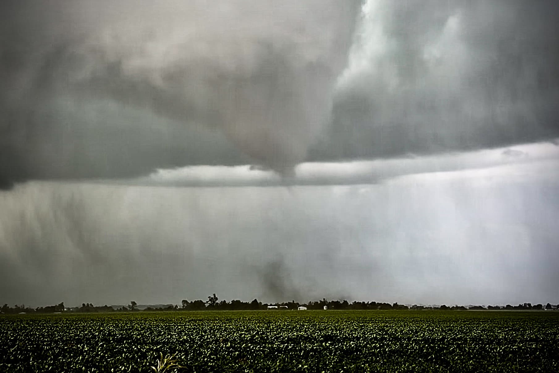
At that point, I looked to my right and saw the tornado moving away from us. I got out of the vehicle despite the pouring rain and began filming. Here is a still shot of the tornado tossing debris as it moved toward the town of Effingham at 8:06 pm CDT.
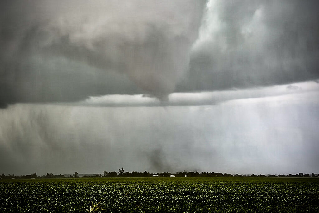
It took the form of a truncated cone tornado at this point, and just before it fully condensed, it became obscured from our view due to rain. However, fellow storm chaser Andrew Newcomb of Extreme Tornado Tours captured some pretty incredible close-range shots of the tornado later in its lifecycle closer to Effingham. These photos have been shared with permission.
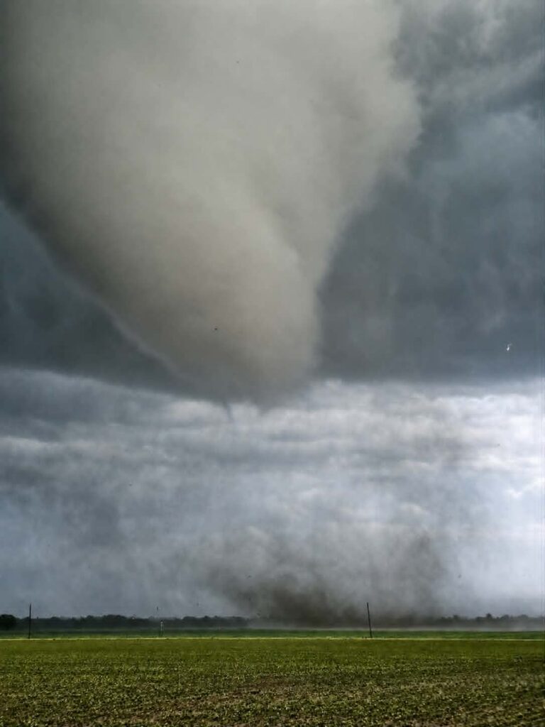
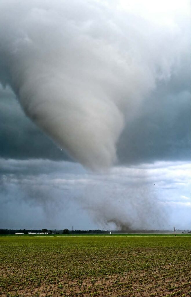
This tornado traveled about 26 miles in total, was rated EF-3, and caused two injuries (non-life threatening) along with significant structural damage, particularly on the north side of Effingham, Shumway, and Sigel. I personally encountered downed trees and power lines all around Beecher City that prevented me from keeping up with the tornado as it moved east. The tornado also significantly damaged homes, railways, contributed to car accidents, and collapsed structures, according to Effingham Fire Department.
Realizing after multiple failed attempts to catch up to the tornado and encountering downed trees and power lines that our chase was over, we began to backtrack our way to Springfield. This proved a challenge in and of itself, as even the roads to our west had significant tree damage to contend with. We finally followed a local farmer out of the area and made our way back to Springfield, where we all went our separate ways.
June 17th was one of my most harrowing tornado encounters to date. To be directy impacted by a developing strong tornado was not on any of our bingo cards and certainly wasn’t the goal, but this is one of the dangers of having to place yourself in front of fast-moving storms in a volatile storm environment.
I do not recommend this approach for unseasoned chasers. These are not setups for the less experienced. Too much can go wrong too quickly, and even seasoned chasers like myself can be caught off guard. We are fortunate that there were grain bins we could shelter next to; otherwise, our story may have ended differently.
Thankfully, we all live on to chase another day, and the community of Effingham pulled together to make a quick recovery.
Written by Jessica Moore
Comments
Join the Conversation