

WBWX – On March 10, 2026, a powerful severe weather setup unfolded across Illinois, creating an environment favorable for significant tornadoes and intense supercell thunderstorms.
What began as a small, seemingly insignificant radar return near Bloomington would rapidly develop into a powerful cyclic supercell, marking the beginning of a remarkable severe weather event that would extend into Indiana.
The Meteorological Setup
The severe weather threat began taking shape days in advance as forecasters monitored an increasingly favorable environment for tornadic thunderstorms across Illinois.
Following a Slight Risk with a 5% tornado probability in Mississippi the previous day, attention shifted northward. The Storm Prediction Center (SPC) initially issued an Enhanced Risk for portions of Illinois in its Day 2 outlook, highlighting a 10% significant tornado probability.
As the day went on, confidence in the developing severe weather threat began to increase, and the SPC upgraded portions of the region to a Moderate Risk in its Day 1 outlook, featuring a 15% significant tornado probability.


Several atmospheric ingredients contributed to the heightened threat. A shortwave trough moving across Illinois, combined with a low-pressure system to the west, provided the forcing necessary for storm development.
Meanwhile, observed Convective Available Potential Energy (CAPE) values exceeded 2,500 J/kg, indicating substantial atmospheric instability. Steep lapse rates approaching 8°C/km and effective wind shear near 50 kts further supported the potential for organized, rotating thunderstorms.
Together, these conditions created an environment capable of supporting long-lived supercells, including storms with the potential to produce multiple tornadoes.
The Drive North
My chase partner, Adrian Ronca-Hohn, and I began our journey north from Mississippi around midnight on March 10, following a full day of storm chasing across the state.
With our initial target set on Peoria, Illinois, we planned to break up the lengthy drive with an overnight stop. We eventually secured a hotel just south of Paducah, Kentucky, where we rested for around six hours before departing around 10 a.m.
By 3 p.m., we had reached northern Illinois, arriving just as daytime heating was beginning to maximize atmospheric instability across the region.
Our timing placed us in a position to intercept developing thunderstorms as the severe weather threat began to materialize.
The Birth of a Monster Supercell
At 3:43 p.m., while traveling north of Bloomington, Illinois, we identified a small but developing thunderstorm on radar.
Although initially appearing as little more than a weak radar return, further examination of the storm’s echo-top heights and surrounding mesoscale environment suggested that it had the potential to intensify rapidly.
We made the decision to follow the developing cell along the I-55 corridor, positioning ourselves to monitor its evolution.
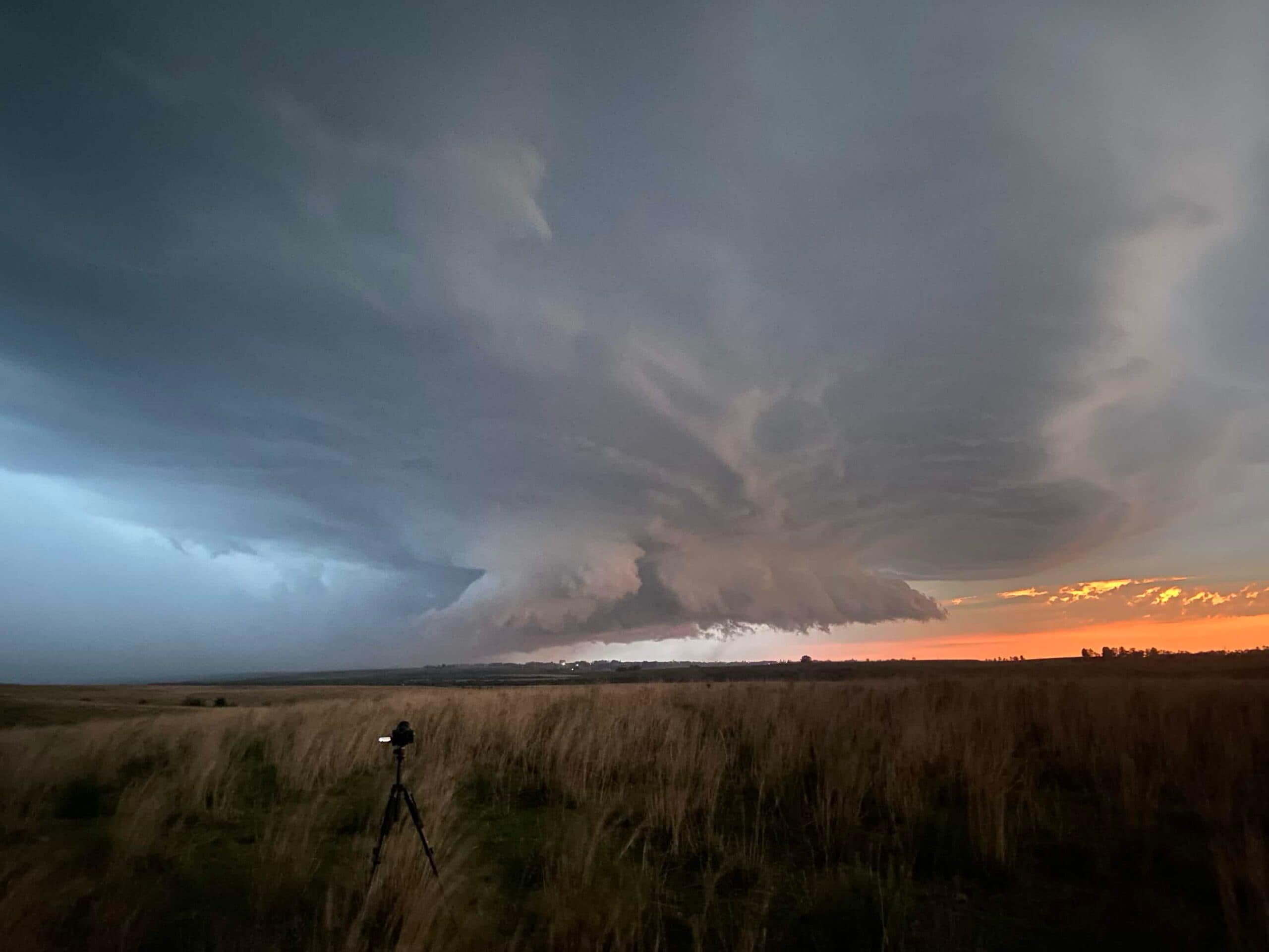
Over the next 45 minutes, the storm underwent significant strengthening, developing into an organized supercell as it moved northeast toward Pontiac.
Pontiac: The First Tornado
By 4:30p.m., we had positioned ourselves just west of Pontiac, Illinois, as the strengthening supercell continued tracking northeast.
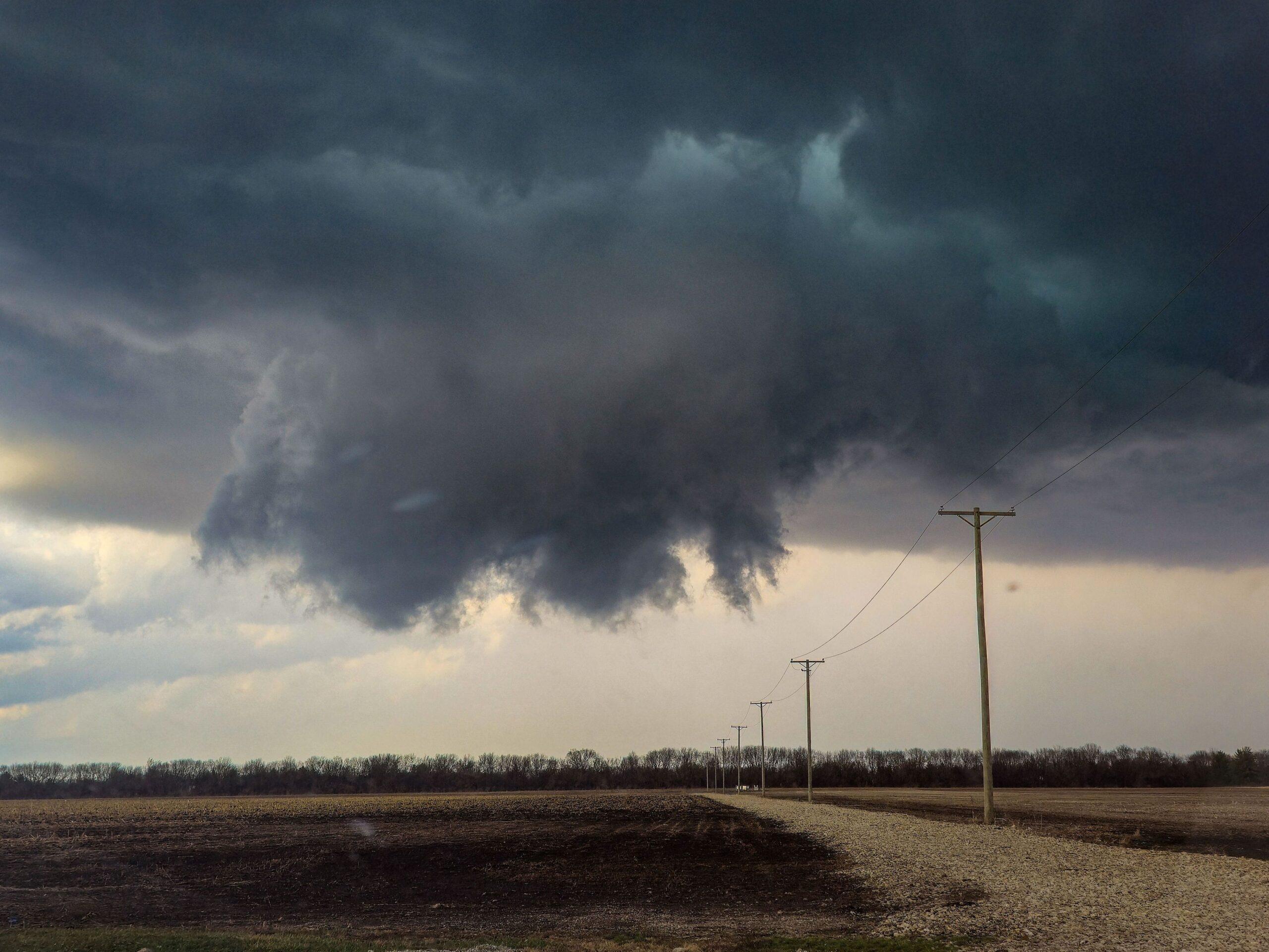
Around 4:40p.m., we found ourselves staring directly at one of the most well-defined wall clouds I have witnessed, located about 400 yards in front of us.
It was then that we realized we were in for a big day.
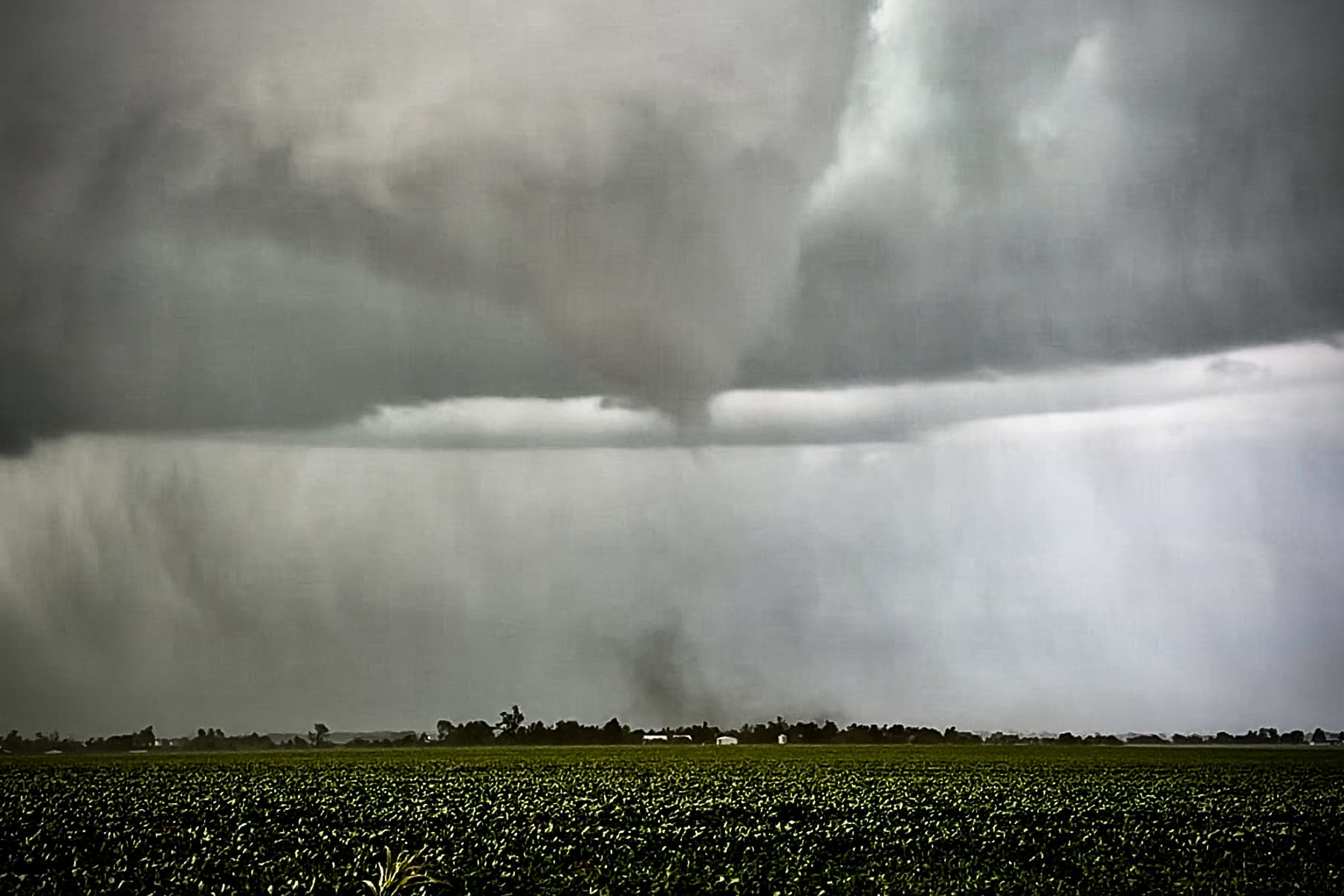
As the storm continued east of Pontiac, its appearance suggested the potential for a large tornado. However, rather than producing the anticipated wedge-shaped tornado, the supercell generated a relatively small, partially condensed EF1 tornado just east of the city.
Despite the relatively modest intensity of this initial tornado, the storm’s organization and favorable surrounding environment suggested that its tornadic potential was far from over.
Kankakee: A Violent Tornado Develops

As we continued tracking the storm eastward across Illinois, its behavior became even more puzzling. Despite displaying impressive structure and persistent signs of strong low-level rotation, the storm had yet to produce the large, violent tornado its appearance suggested was possible.
Visually, the supercell appeared capable of producing a significant tornado, yet something seemed to be missing from the environment.
That would change as the storm approached Kankakee.
Around 6:20 p.m., that last puzzle piece fell into place: the lake-breeze boundary from Lake Michigan. As the supercell began interacting with the lake-breeze, the low-level convergence and wind shear was likely enhanced, providing the additional ingredient for tornadogenesis.
Ten minutes later, around 6:30 p.m., a large stovepipe tornado touched down between Kankakee and Aroma Park.
As the tornado tracked northward, its circulation expanded. What initially appeared as a narrow stovepipe evolved into a massive wedge tornado, eventually reaching a maximum width of 0.88 miles.

After following the supercell since its early development near Bloomington, we were now witnessing the violent tornado we had feared the storm could produce.

Wheatfield: The Supercell Crosses Into Indiana
Following the Kankakee tornado, we briefly stopped to assess damage and check on the well-being of those in the affected area before continuing eastward into Indiana.
By this point, the supercell had slowed, moving around 20 mph. Its reduced forward speed allowed us to regain position and continue documenting the storm as it crossed the state line.
At approximately 7:56 p.m., we witnessed another fully condensed tornado develop just south of Wheatfield, Indiana.
The tornado was rated EF1, with estimated peak winds reaching 110 mph and a maximum reported width of approximately 900 yards.
Knox
At approximately 8:06 p.m., the Wheatfield tornado dissipated. However, the storm’s tornadic activity was far from over.
Within just one minute, the supercell underwent another rapid cycle, producing a new tornado at approximately 8:07 p.m. just north of San Pierre, Indiana.
As the tornado strengthened and continued across the region, conditions became serious enough to prompt the second Tornado Emergency of the evening.
A Tornado Emergency is an exceptionally urgent warning issued by the National Weather Service when a confirmed, dangerous tornado poses a significant threat to life and property in a populated area.
At approximately 8:21 p.m., we caught up with the tornado just south of North Judson, Indiana, where we continued observing and documenting its progression.
The tornado remained on the ground as it moved through the region, eventually dissipating at approximately 8:43 p.m.
Its 36-minute lifespan marked another significant chapter in an already extraordinary evening of severe weather.
From the moment we first identified the developing thunderstorm near Bloomington to the final tornado we documented in Indiana, the supercell demonstrated remarkable longevity and persistence.
The repeated development of tornadoes across Illinois and Indiana illustrated the dangerous nature of cyclic supercells and the importance of understanding how changes in the surrounding atmosphere can influence tornado development.
For us, March 10, 2026, was more than just another day of storm chasing. It was an opportunity to witness firsthand the evolution of a powerful supercell, from its earliest stages of development to its repeated production of significant tornadoes across two states.
Comments
Join the Conversation